Sign up for the larongeNOW newsletter
The La Ronge Dam with sandbags in place. (submitted photo/Water Security Agency)
very high water

Northern water level update for Friday, August 7

Aug 7, 2020 | 2:00 PM

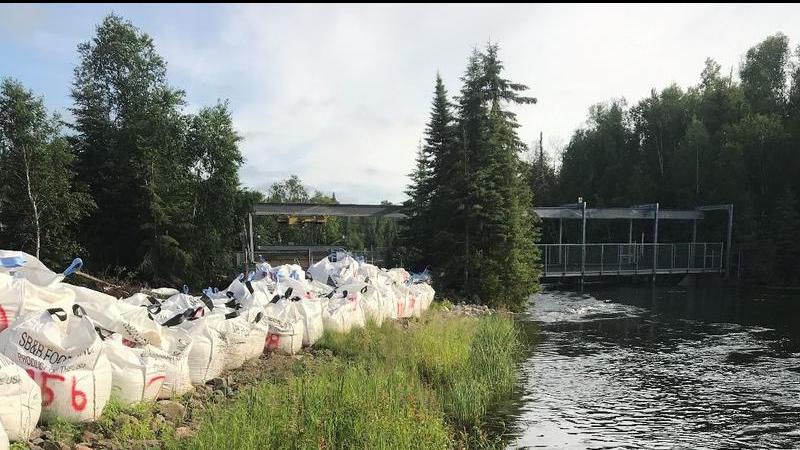
The Water Security Agency has released its latest update on water levels as the extremely wet spring and summer continues. It appears most areas have reached or are very close to their peak but more rain is expected in areas in the coming days.

Rainfall

Northern Saskatchewan received extremely high cumulative precipitation since April 1, 2020, resulting in very high flows and lake levels across the Churchill River and Lower Saskatchewan River basins.

Much of this rainfall has come in the months of June and July. Minimal precipitation has been observed over most of the north over the past 11 days which has allowed flows and levels to peak in many locations. The exception is the far northwest, near Lake Athabasca, where some rainfall has been observed.

Flows and Lake Levels: High river and lake levels can be expected for the remainder of summer and in some cases, such as the mainstem of the Churchill River, into the fall and winter. In most areas flows and water levels are expected to peak, or have peaked, slightly lower than previous historical highs. However, flows and levels in the Lower Churchill River, including Reindeer River and Churchill River near Sandy Bay, have exceed previous historical highs.

Below are specific conditions at various locations as well as projected future peak levels.

Ile a la Crosse

Present elevation: 421.08 m

It appears as if levels at Lac Ile a la Crosse are at peak; however, they are expected to remain high for some time resulting in a risk of wind and wave action resulting in short-term higher levels.

Lac La Ronge

Current elevation: 364.92 m
Projected peak: 364.94 m on or near August 18, 2020

With minimal precipitation throughout the basin over the past week, inflows appear to have peaked and the lake appears to have leveled off; however, there is more rain in the forecast over the next few days. Our current forecast has the lake peaking just shy of the 2011 peak. If conditions remain dry, the lake level will track in the lower portion of the confidence band shown on the hydrograph.

Sandy Bay

Present Elevation: 9.87 m (2310 m3/s)
Observed peak: 10.14 m (2400 m3/s) on August 4

Water levels at Sandy Bay reached a peak on August 4 and are now down about 0.27 m. Flows and levels are expected to continue to decline over the short term but may climb early next week in response to rainfall over this coming weekend.

Meeting Lake

With warm and dry conditions over the past week, levels at Meeting Lake have dropped by about 1 cm from its peak. August 6, 2020 lake level is 739.47 m. Outlet spill elevation is 739.23 m (24 cm lower than current lake level). Meeting Lake has reached its outlet and is confirmed flowing into outlet channel. There is not significant flow moving through outlet currently as it is congested with thick vegetation. Berms around the lake should now be built to WSA recommended standard (739.83-740 m)

Cumberland House

Cumberland Lake has peaked and is receding. Forecasted levels for Cumberland Lake are part of WSA’s 10-Day Saskatchewan River Forecasts which can be found here.

Jan, Amisk, and Deschambault Lakes Jan Lake peaked in late July, 54 mm above 2017 levels. While we do not have any current information for Deschambault or Amisk Lake, with the Sturgeon Weir River at Leaf Rapids continuing to climb, these lakes are likely not yet at peak. Like Jan Lake, peaks that are slightly above 2017 levels are expected at these locations unless significant, additional precipitation is observed.

Future Rainfall

Most of the north is expected to receive in excess of 30 mm of rain over the weekend, beginning late Friday near the Alberta border and ending on Monday near the Manitoba border. Highest accumulations are expected in the extreme northwest, near Lake Athabasca, which is already at a record high level. Some models are suggesting in excess of 75 mm of rainfall over the weekend for this area.

WSA will monitor rainfall over the weekend and update forecasts early next week.

panews@jpbg.ca

View Comments