Subscribe to our daily newsletter

Mapping project highlights residential school legacy

Dec 18, 2017 | 4:00 PM

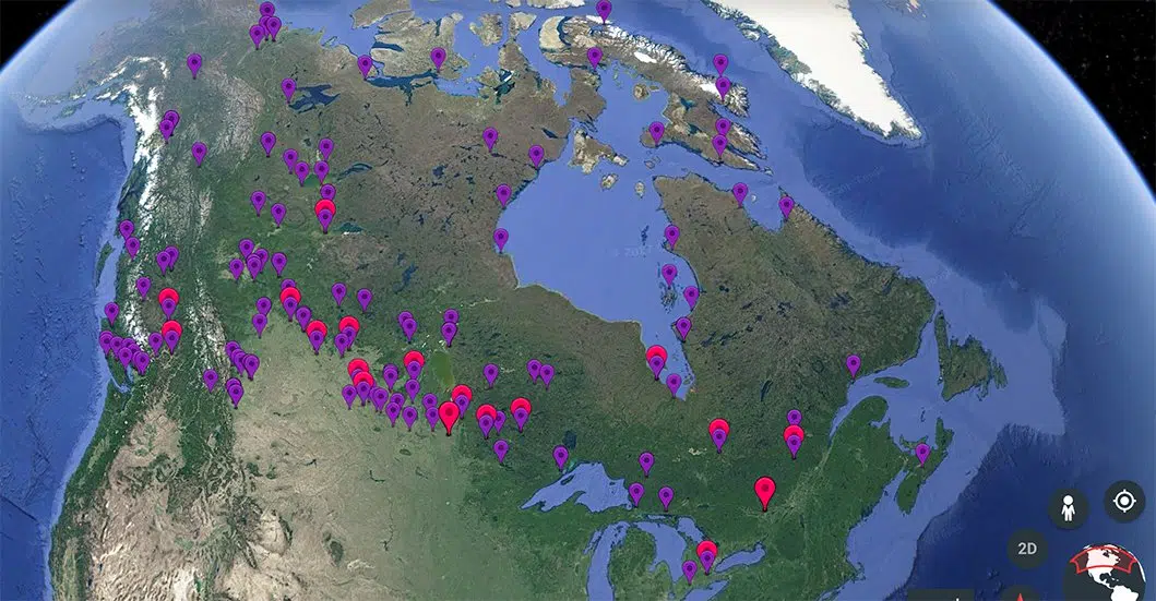
A new feature available through Google Maps highlights a dark part of Canadian history.

Canadian Geographic Education and the National Center for Truth and Reconciliation produced a map of almost every residential school in Canada. The map pinpoints their historical locations and features a bit of background information for a few of them.

“I believe Canadian Geographic wants to see this used and utilized in as many classrooms as possible,” Andrew Kitchen, the Saskatchewan representative for Canadian Geographic said. “It is a part of our history, and it is a part of our history that we need to learn from… so we can learn and grow and not make these mistakes again.”

Kitchen said the resource is aimed at teachers, but the project is available for the anyone to view. He said he’s working to raise awareness with teachers in the province about the new map.

A few select points in Saskatchewan contain information about residential schools. The location of the Battleford Indian Industrial School takes a look at a damming report issued by Nicolas Flood Davin. Prince Albert is highlighted with information about the stress and emotional neglect residential school survivors faced in the system. The Lebret residential school’s marker takes a look at the impact the first haircuts had on residential school attendees.

While many stories are laid out, both the Lac La Ronge and Beauval schools are devoid of supplimentary information. Kitchen said the project is still growing, and he’d like to see stories from those schools shared as well. The information used in the map was provided by the National Centre for Truth and Reconciliation, Kitchen said, but he’d like to see more stories added. Kitchen said he hadn’t done any work with the Federation of Office of the Treaty Commission so far, but said he would love the opportunity to do so.


Bryan.Eneas@jpbg.ca

On Twitter: @BryanEneas