Click here to sign up for our free daily newsletter
Nistowiak Falls is where Lac La Ronge meets the Churchill River. (Derek Cornet/larongeNOW Staff)
High Water

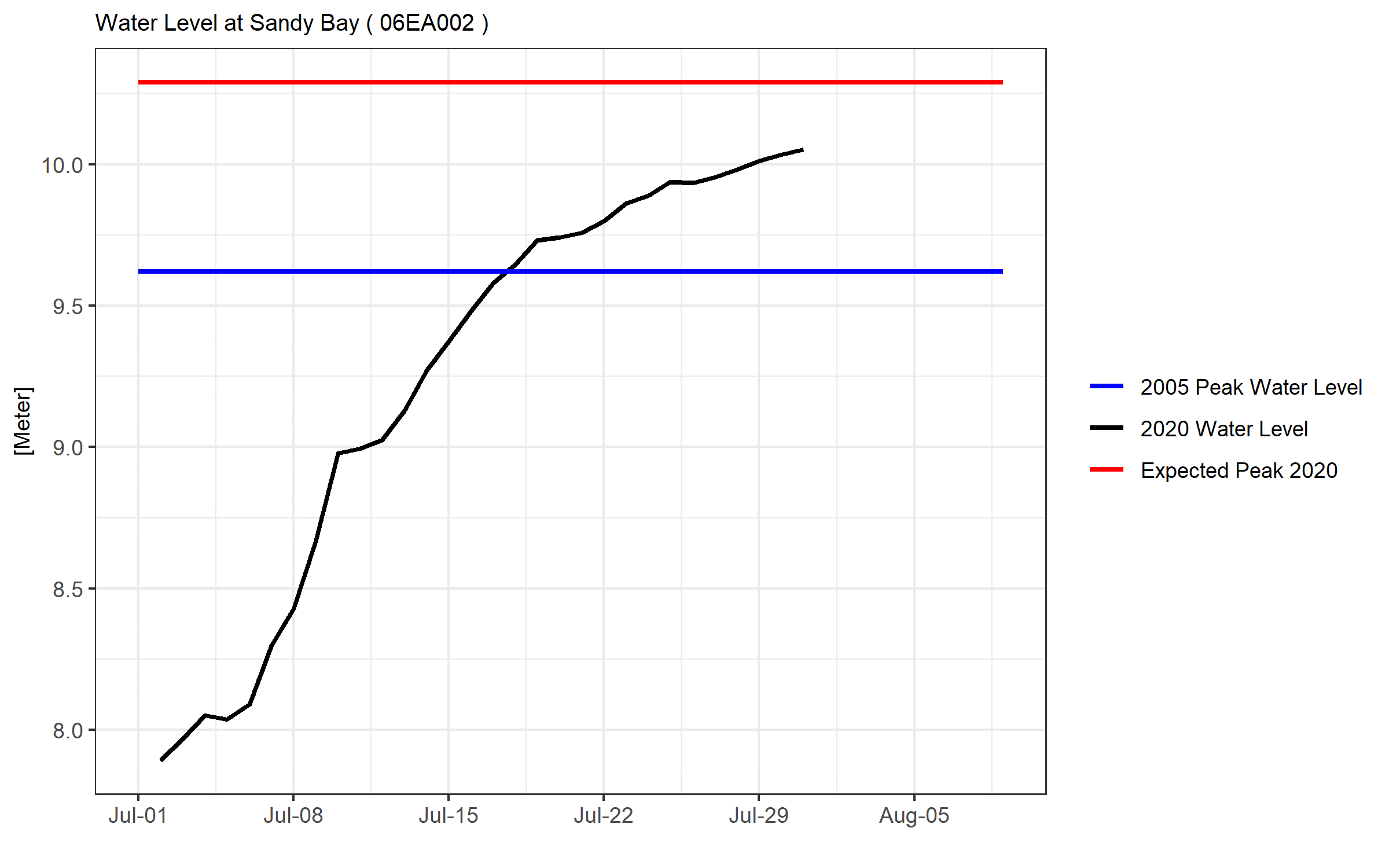
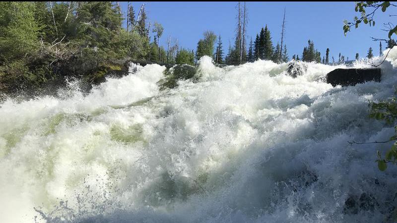
Reindeer River, Churchill River near Sandy Bay, exceed historical highs

Jul 31, 2020 | 3:22 PM

The Water Security Agency (WSA) has released an update for northern Saskatchewan ahead of the August long weekend.

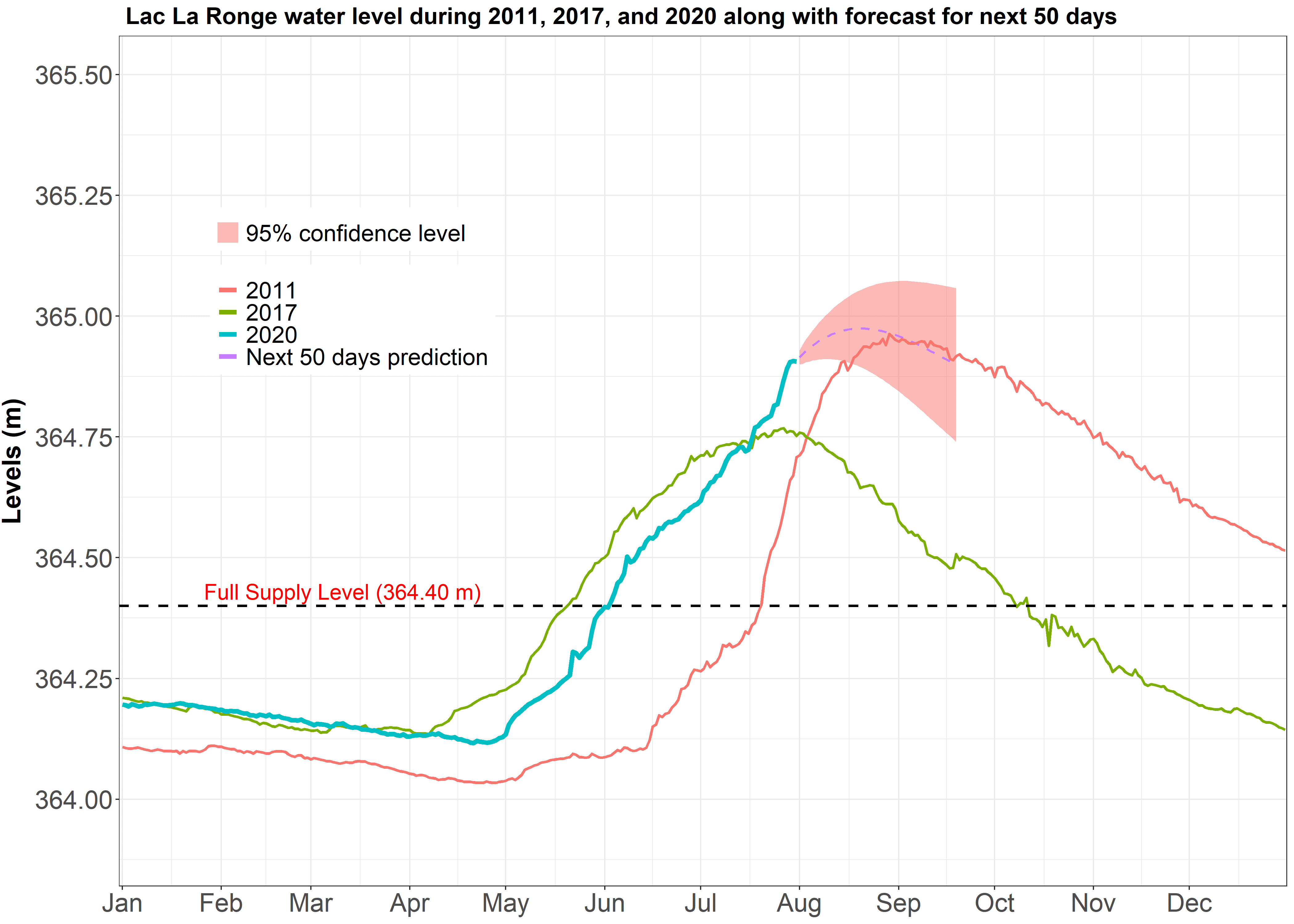
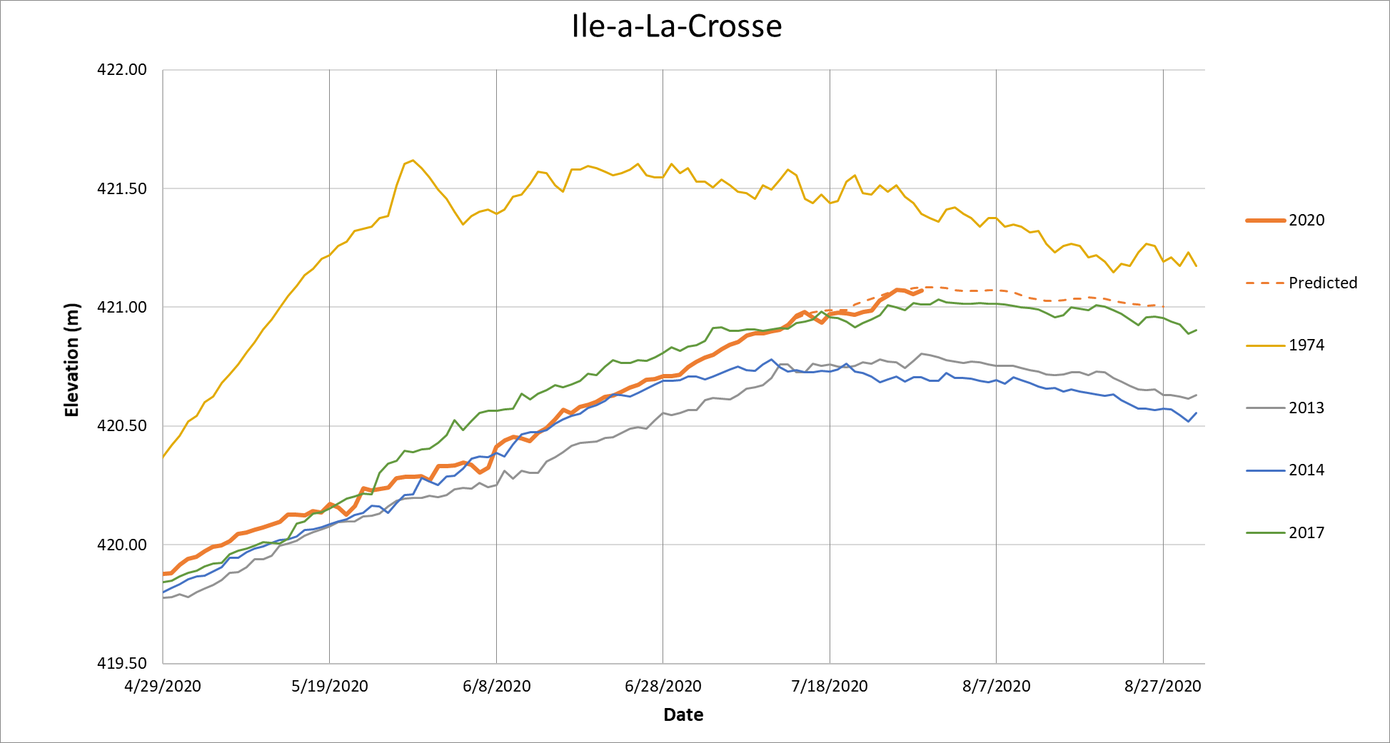
According to the update, northern Saskatchewan has received extremely high cumulative precipitation since April 1, resulting in very high flows and lake levels across the Churchill River and Lower Saskatchewan River basins. Much of this rainfall has come in the months of June and July, and much of the central portion of the province has received record or near record precipitation over the past two months.

Rainfall over the past three days has been negligible over the Churchill and Lower Saskatchewan river basins where water levels are highest.

“High river and lake levels can be expected for the remainder of summer and, in some cases, such as the mainstem of the Churchill River, into the fall and winter,” the update states. “In most areas flows and water levels are expected to peak, or have peaked, slightly lower than previous historical highs.”

Flows and levels in the Lower Churchill River, including Reindeer River and Churchill River near Sandy Bay, however, have exceed previous historical highs.

For Lac La Ronge, the current elevation is at 354.9 metres and the projected peak will be 364.97 m on or near Aug. 20. The update notes with drier conditions over the last few days closer to Lac La Ronge and minimal precipitation over headwater areas over the past week, inflows appear to be near peak and lake level rises are also slowing in response. If conditions remain dry, the lake level will track in the lower portion of the confidence band shown on the hydrograph.

Lac La Ronge levels since January 2020. (Water Security Agency)

Sandy Bay is expected to peak at 9.29 m on or near Aug. 4 and is at a present elevation of 9.06 m. SaskPower has begun to reduce outflows at the Whitesand Dam and this reduction will offset some of the higher flows arriving from further upstream.

Sandy Bay water levels since July 1. (Water Security Agency)

The current elevation for Lac Île-à-la-Crosse is 421.07 m and the estimated peak was 421.1 m on July 28. The WSA added it appears as if levels at Lac Ile a la Crosse are at peak, and they are expected to remain high for some time resulting in a risk of wind and wave action leading to short-term higher levels.

Lac Île-à-la-Crosse water level since the end of April. (Water Security Agency)

Cumberland House is at an elevation of 267.63 m as of July 27 and the peak was observed July 24. With Cumberland Lake well into its recession and the threat of higher levels diminishing, it will not be included in future updates.

derek.cornet@jpbg.ca

Twitter: @saskjourno