Subscribe to our daily newsletter
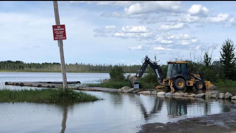
Beaches and boat launches in the tri-communities are flooded. (Derek Cornet/larongeNOW Staff)
Northern Sask.

Lac La Ronge water levels expected to begin falling this weekend

Aug 21, 2020 | 1:15 PM

The water level on Lac La Ronge is expected to reach its yearly peak tomorrow.

That’s according to the Water Security Agency (WSA), which stated in a news release the projected peak will be at 364.96 metres. Since June 3, the level of Lac La Ronge has increased by approximately by 0.6 m.
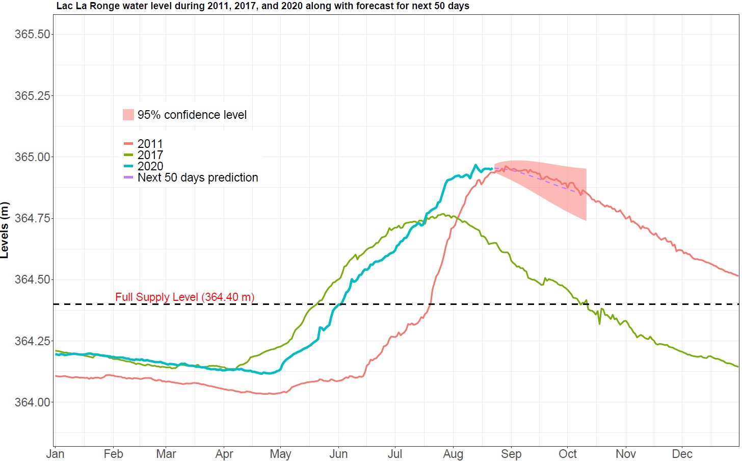
Lac La Ronge water levels since January 2020. (Water Security Agency)

“It is postulated that subsurface inflows could be increasing and offsetting the declines in surface water inflows, holding the lake level relatively steady over the past eight day,” the release noted. “It is our expectation that declines in the lake level will be observed in the coming days unless additional rainfall is received over the basin.”

Northern Saskatchewan has received extremely high cumulative precipitation since April 1, resulting in very high flows and lake levels across the Churchill River and Lower Saskatchewan River basins. Much of this rainfall occurred in June and July and its expected high river and lake levels will continue for the remainder of summer and in some cases, such as the mainstream of the Churchill River, into the fall and winter.

The WSA mentioned conditions have been warm and dry over the past week, resulting in increased evaporative losses and declining flows across the North. Rainfall over the past week was generally less than five millimetres from Meadow Lake Provincial Park over to the Prince Albert National Park. Further North, accumulation generally ranged from 10 to 15 mm with a localized accumulation of 31 mm near Fond du Lac.

“A larger system is expected to move into northern areas of the province on Saturday, bringing general accumulations ranging from five to 30 mm across the North,” the release states. “The greatest concern at this time is at Lac La Ronge, but it appears that rainfall over the coming days will be limited to 10 mm or less in this area, based on current forecasts.”

On July 29, the La Ronge Dam was reclassified by the WSA from a hazardous condition to a potential dam failure. The La Ronge Dam is 3.5 m and sandbagging raised it by 0.5 m.

For Lac Île-à-la-Crosse, water levels are beginning to show some declines, however, they will remain higher than normal for the remainder of the open water season and vulnerable to additional rainfall events and wind events. The current elevation is 421.09 m.

Waters levels for Lac Île-à-la-Crosse. (Water Security Agency)

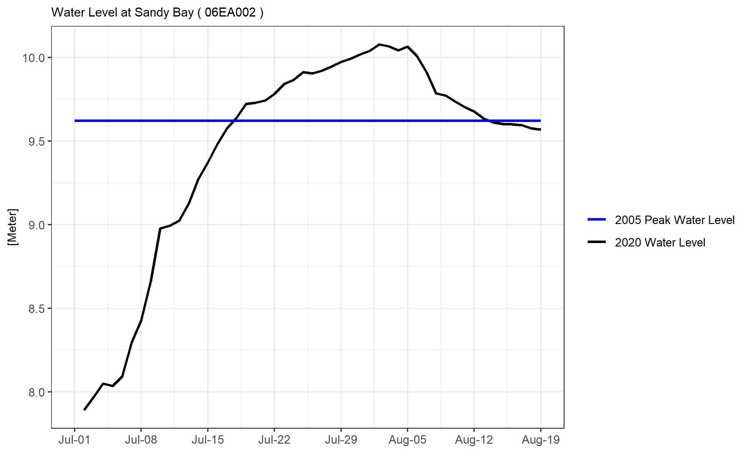
Water levels at Sandy Bay reached a peak Aug. 4 and are now down about 0.6 m, which is below the 2005 peak. Flows and levels are expected to remain relatively steady for the next week. A reduction of 300 m3/s in the Whitesand Dam outflow on the Reindeer River occurred earlier this week. This reduction will help to lower water levels further at Sandy Bay in late August and early September.

Water levels for Sandy Bay. (Water Security Agency)

derek.cornet@jpbg.ca

Twitter: @saskjourno

View Comments